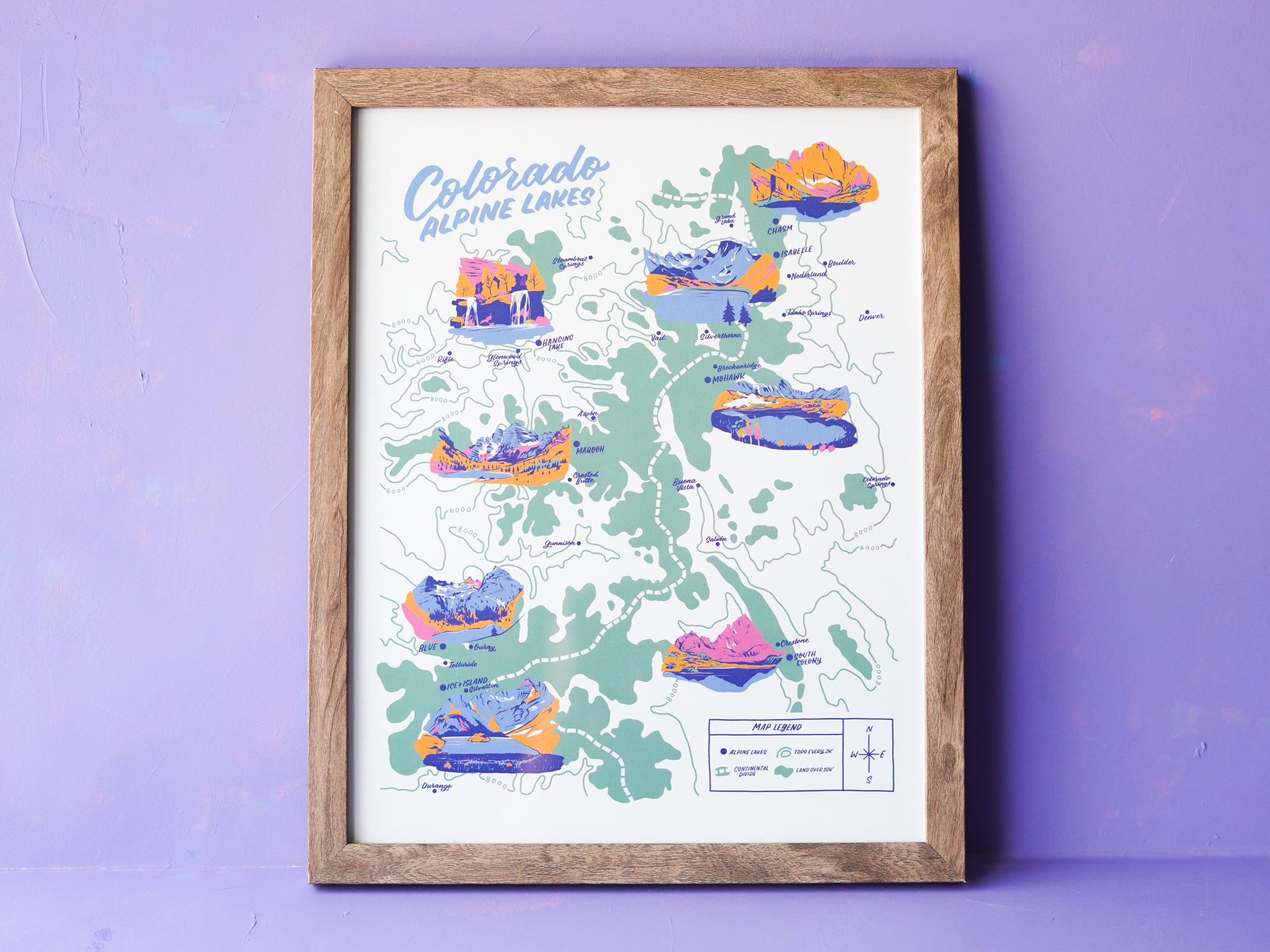
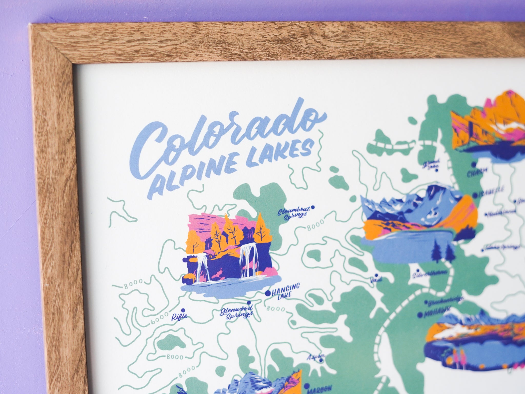
Colorado Alpine Lakes Map - 11x14"


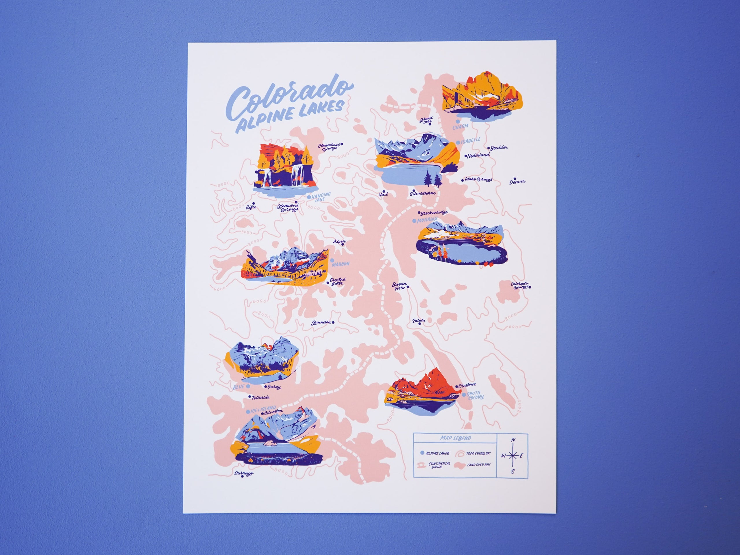


New green colorway! OG pink colorway is on sale before we discontinue it.
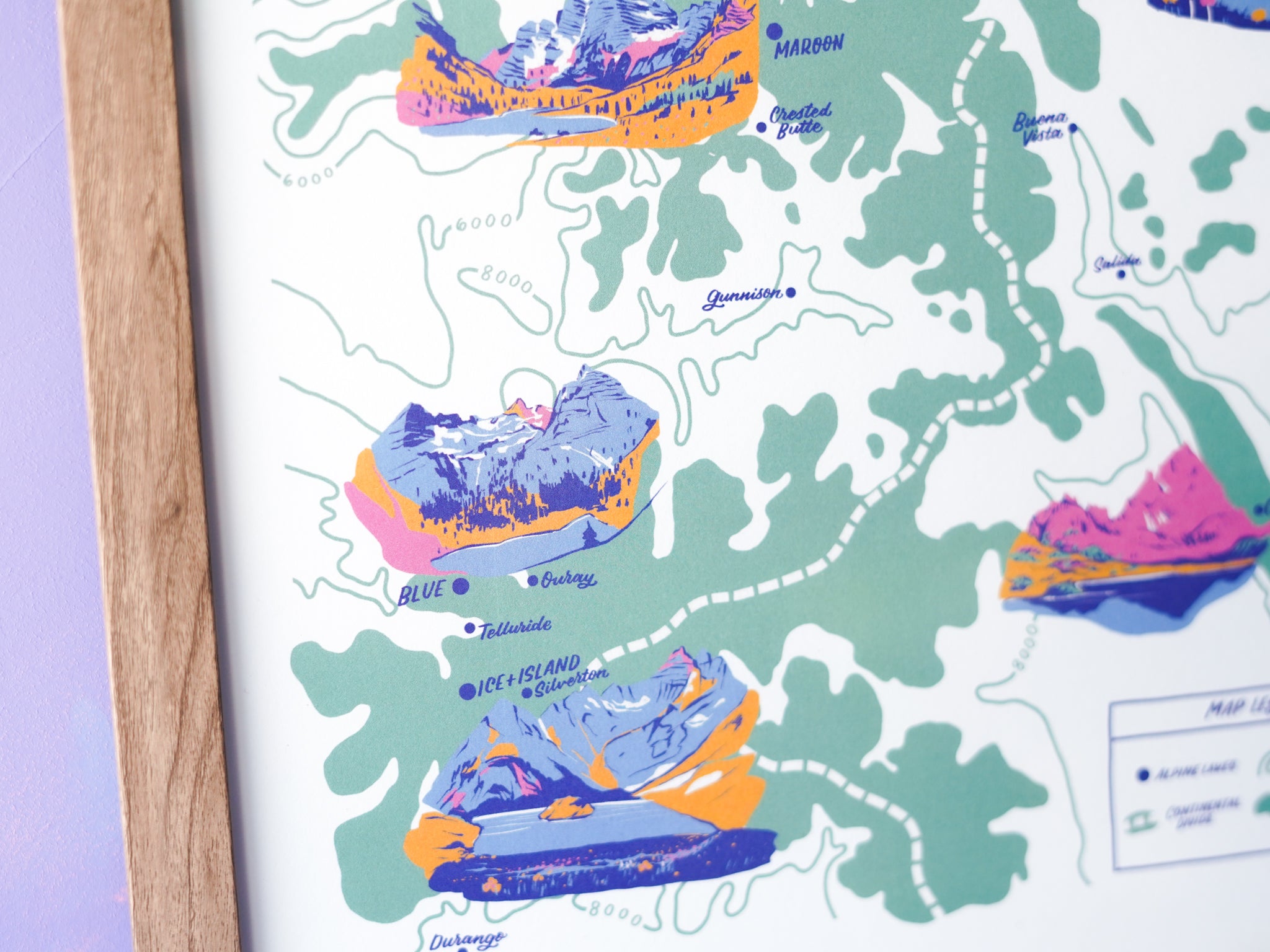
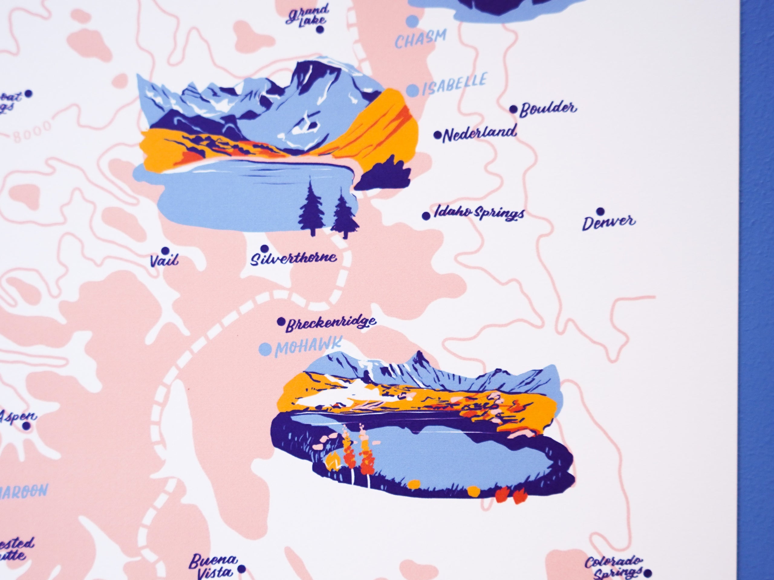
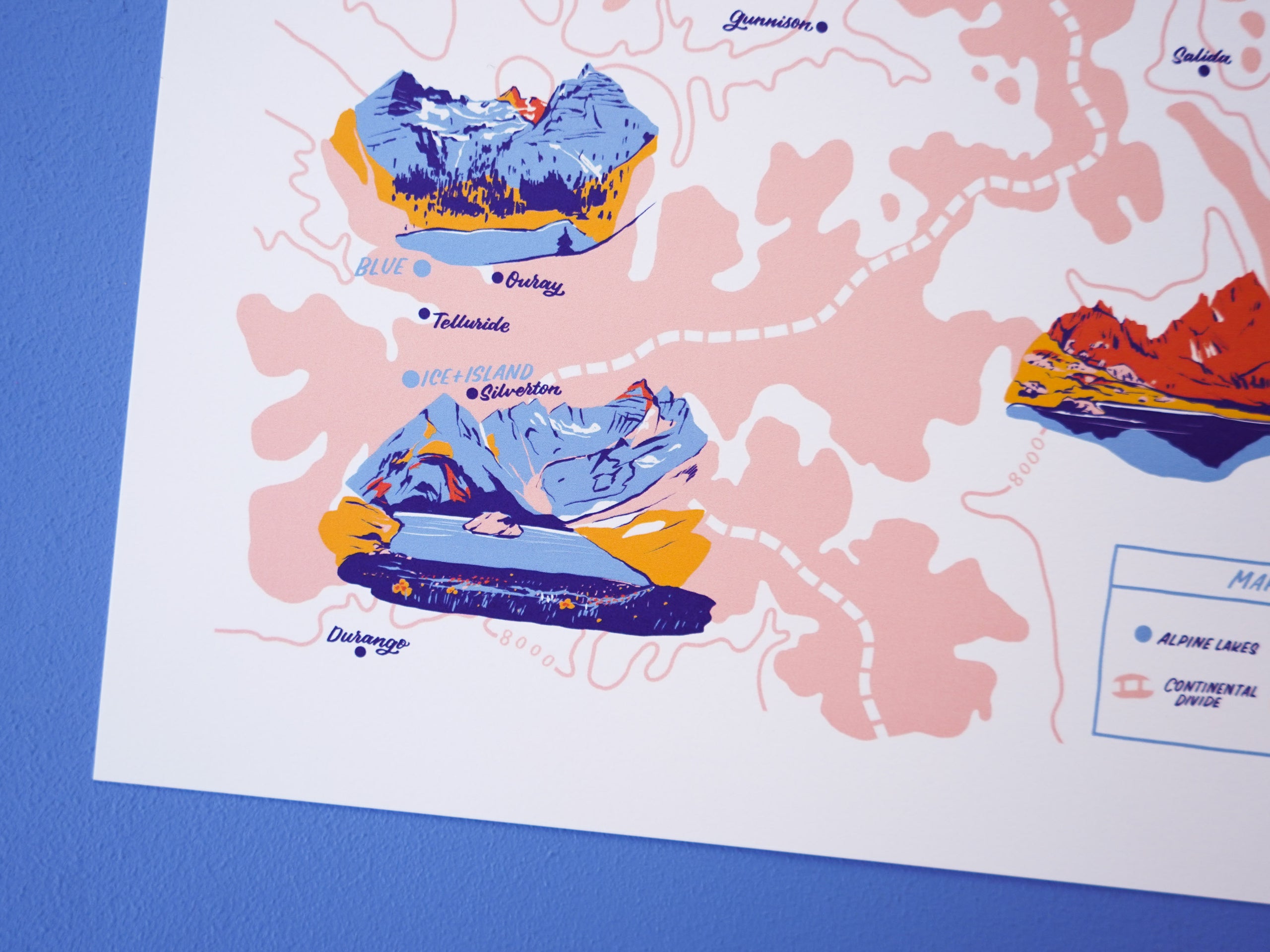
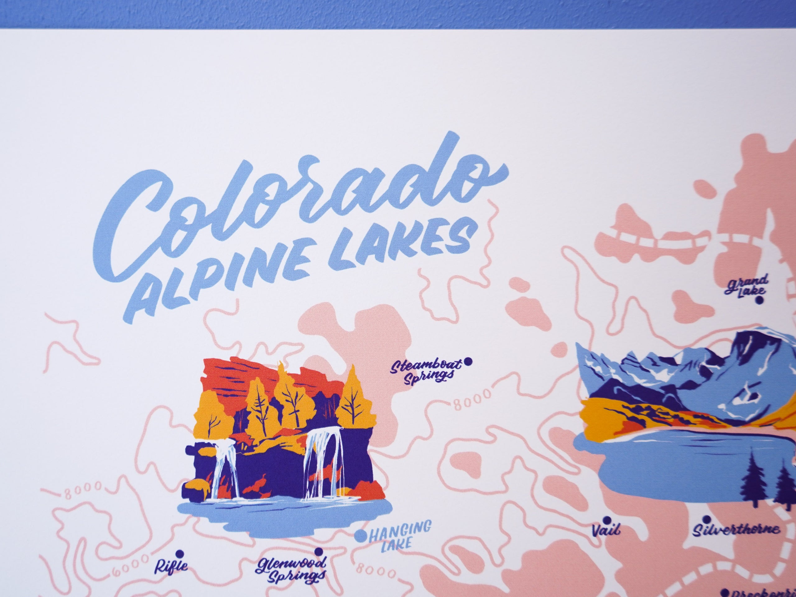
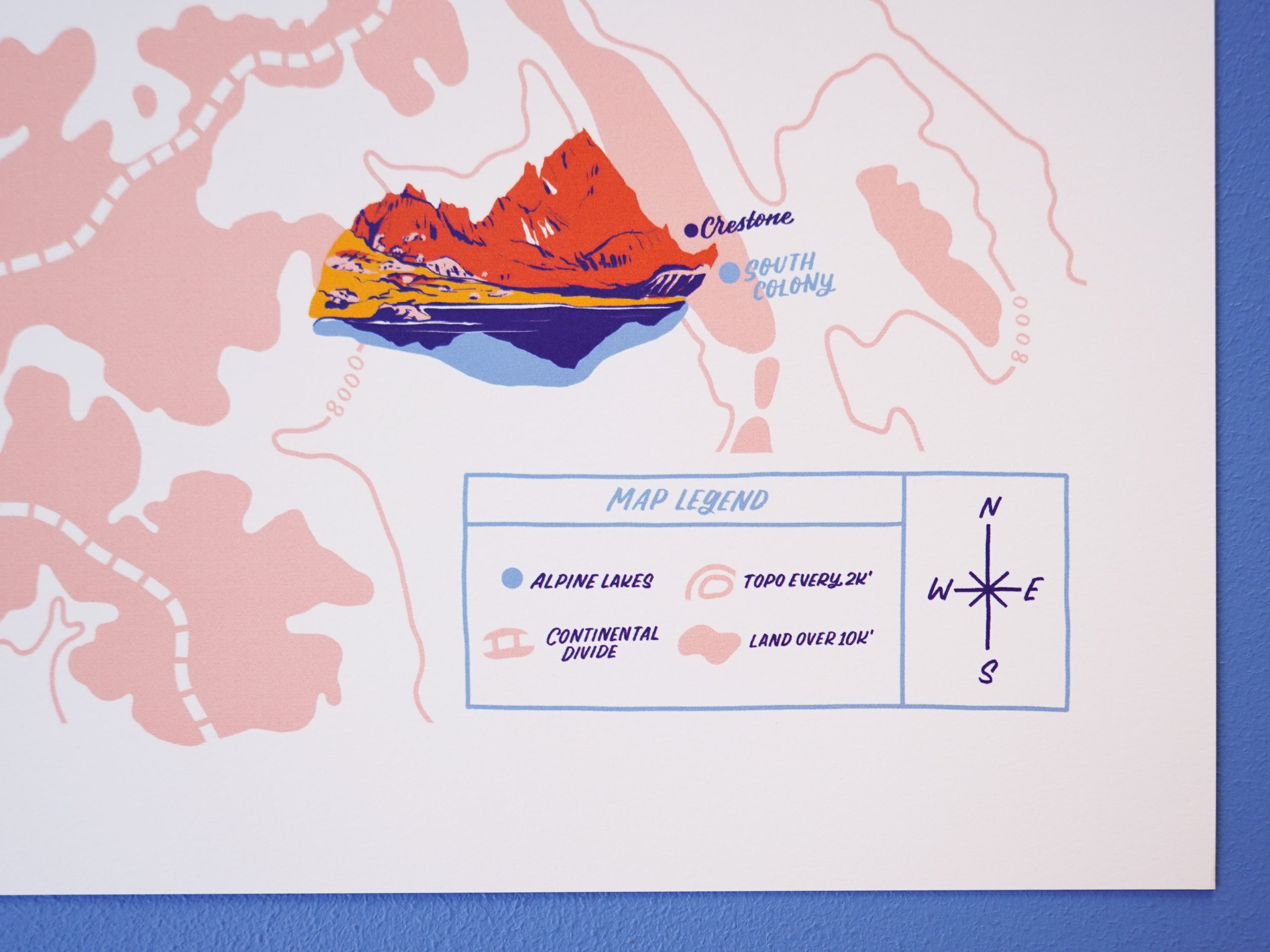
Colorado is home to hundreds of stunning alpine lakes, which are usually defined as being over 5,000' elevation and fed by mountain runoff and glaciers. They're some of the best gems in the state and we spend our summers on long hikes to reach these crystal clear beauties. We illustrated 8 alpine lakes throughout Colorado to feature on this map.
- Hanging Lake near Glenwood Springs
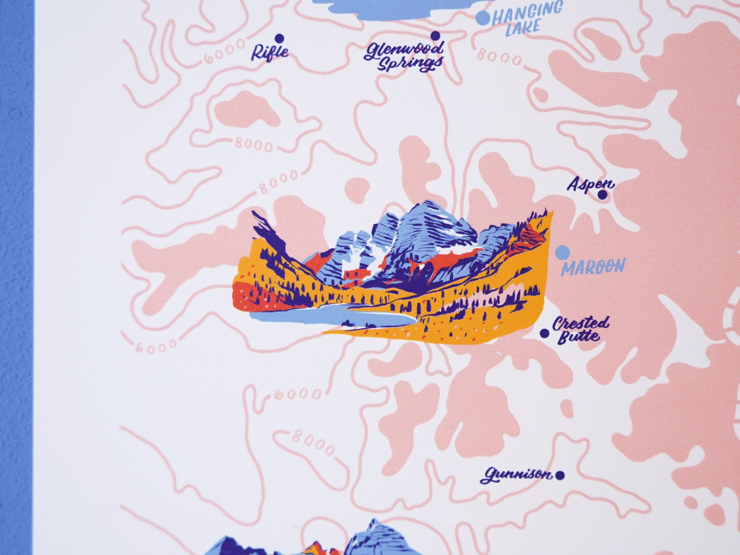
- Maroon Lake at Maroon Bells near Crested Butte
- Blue Lakes near Ridgeway between Telluride and Ouray
- Ice + Island Lakes south of Silverton in the San Juan Range
- Chasm Lake at the base of Long's Peak in RMNP
- Lake Isabelle along the Brainard Lake trailhead near Nederland
- Mohawk Lakes near Breckenridge in the Arapaho National Forest
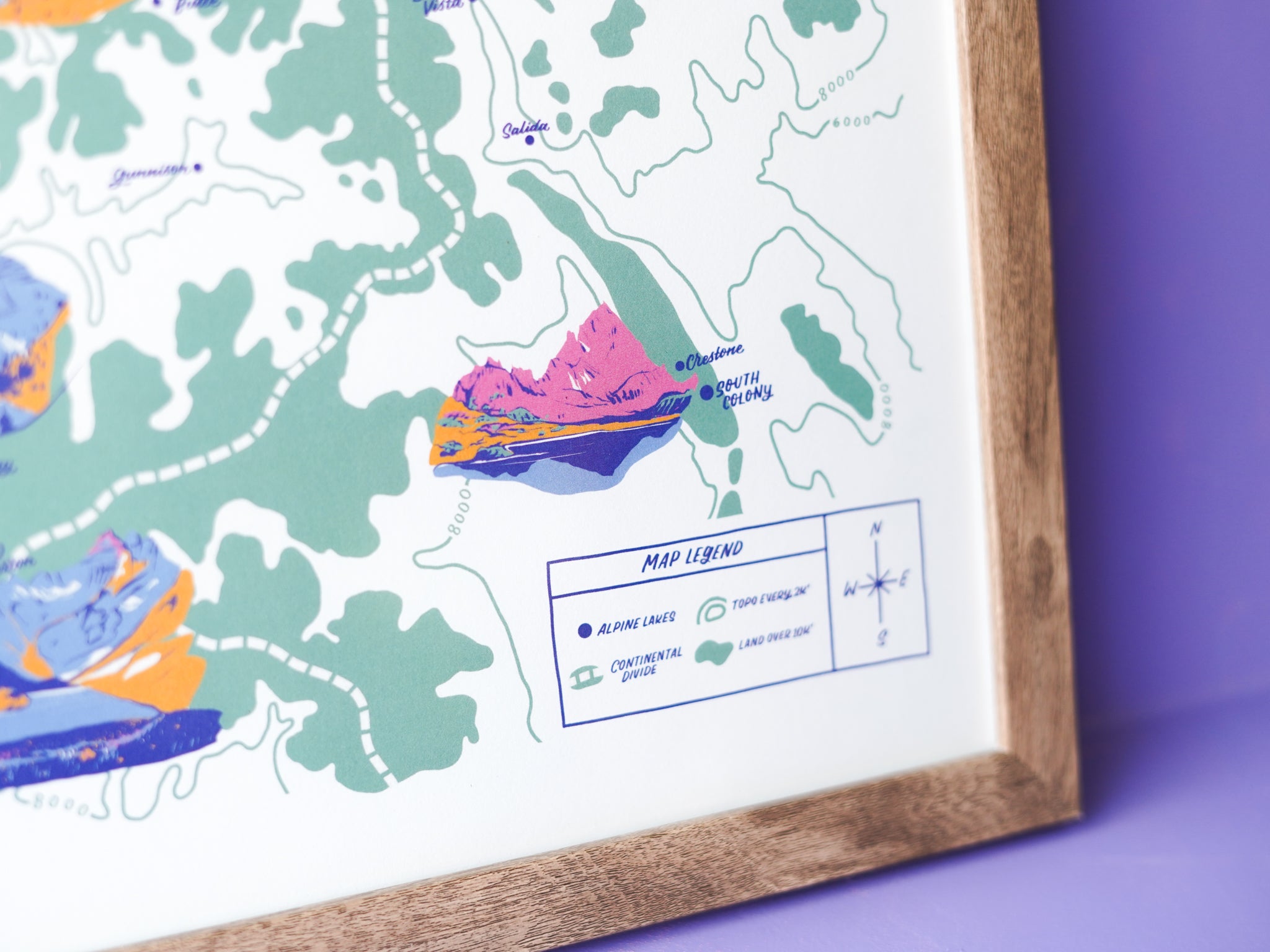
- South Colony Lake down in the Sangre de Cristo wilderness near Crestone
Hand-drawn 11x14" map print of 8 Colorado alpine lakes on a backdrop of accurate topography every 2k'. Fade resistant 11×14ʺ print with archival ink on 19 pt Savoy Cotton paper. Frame not included.